At the end of each year I look back at the images I have taken and select several to highlight in a year-end post. This year I have selected 15 photos to share and discuss. Whether these images are my “best” or not, I am not sure. But, they are all images that gave me a sense of achievement in expressing my vision.
Winter Scenes
I will start with four images I took in the winter. Winter is my favorite time to do photography. I love being outside in the winter. I find the cold and the snow to be invigorating. Snow can be a landscape photographer’s friend helping to reduce the chaos that so often typifies a scene in nature, especially in a woodland. I have photographed this sumac several times over the years, but found it difficult to get it to stand out from the trees behind it. I made this photograph in a snow storm, which helped to reduce the chaos in the scene, creating separation between the twists and turns of the sumac and the forest in the background.

I first came across this lone tree in a farmer’s field in the fall of 2021. I described it then as one of my “U-Turn” photos – a scene that caught my eye as I was driving by and caused me to do a u-turn. It happened again this past winter. I drove by this tree while it was snowing and again did a 180 and pulled off by the side of the road. A lone tree is a frequent subject for landscape photographers. It can evoke a range of emotions, such as isolation, tenacity, or independence. Having captured a photo in the fall and winter, I will have to return to this spot in the spring and summer to document it in all four seasons.

Walking along Shalda Creek where it enters Good Harbor Bay in the Sleeping Bear Dunes National Lakeshore, I saw these stones frozen in ice. As I photographed them, a haiku came to mind:
Stones encased in ice
Imprisoned by winter’s cold
The beach in February
A good photograph has something in common with a haiku. A haiku expresses its meaning in three spare lines – no wasted words or syllables. In a photograph, everything has to contribute – no extraneous things to distract from the subject.

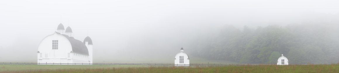
On my frequent drives to the Leelanau Peninsula, I pass the Weldon Township Cemetery in a clearing cut from the forest. I have stopped several times to try and capture the emotion of the scene without success. But, the winter’s snow helped to emphasize the simplicity of this hallowed place and to convey a sense of repose and honor.

My Swan Vigil
In March, I went for a walk along Reeds Lake in East Grand Rapids, Michigan, and came across a swan sitting on a nest. I continued to visit the nest for two and a half months, hoping to be able to document the hatching of the swan’s nine eggs. The eggs never hatched, but I was able to put together a blog piece on my vigil. Here is the link. The male swan (the cob) was very protective of the nest. In this first photograph, the swan is taking off to confront another pair of swans a couple hundred yards away – apparently too close for the cob.

In the area of the swans’ nest there were many nesting geese. The cob policed the area to let the geese know their place in the order of things. Photographing birds was a challenge for me. I take photos of landscapes with my camera on a tripod, often with a long exposure time. I have the luxury of time to frame a shot and try different apertures and focal lengths. But birds don’t wait for you. You have to react and hope that you snap the photo at the decisive moment. I learned to observe and anticipate.

Iceland
In September, my wife and I visited Iceland. We concentrated our journey in Reykjavík, on the Snæfellsnes Peninsula, and along the southern coast. Iceland is an amazingly beautiful country. Berserkjahraun, seen below, is a vast lava field on the Snæfellsnes Peninsula that formed 4,000 years ago. The lava field is covered with moss and lichen and offers a stunning view with mountains in the background.

I had never photographed the northern lights before. I got the opportunity when we rented a cottage on the southern coast, near Kirkjubæjarklaustur. We watched for nearly four hours as the aurora filled the night sky. The naked eye saw only the greenish colors, which danced in the sky. But, a longer exposure – nine seconds or so – captured the magenta.

On the southeast coast of Iceland is Jökulsárlón, a glacial lagoon dotted with icebergs that break off a glacier and make their way to the sea. My eye was attracted to the layers of tones in this scene.

Iceland has over 10,000 waterfalls. Probably the four most visited falls are Öxarárfoss at Þingvellir, Gullfoss on the Golden Circle, and Seljalandsfoss and Skógafoss along the south coast of the country. All have large parking areas to accommodate the tourists who flock to the sites. We ventured off the main highway to a less visited waterfall, Gluggafoss, also known as Merkjárfoss, where we had the site almost to ourselves (other than the one woman in a bright red coat who kept walking into my photo while talking on her cellphone). Gluggafoss falls in two stages and has a total height of 171 feet. The lower falls are captured in the photo below.

Black and White
I continue to try to develop my eye for processing photos in black and white. Gluggafoss rendered well as a black and white photo, with a broad range of tones.

Back home in Michigan, I look for scenes that I think will be effective in black and white. Processing in black and white reduces a scene to its essence. It relies on structure and form, light and shadow to carry the photograph’s meaning. The great Magnum photographer Elliott Erwitt, who died in November, said of black and white photography, “Color is descriptive. Black and white is interpretive.”

I am attracted to the roots of trees, so I was excited when I came upon these cedar trees along the shore of Lake Michigan. Waves had eroded the shore exposing the lateral roots and tap root that have supported the trees for tens of years. Another period of high water and waves will likely mean the end for these trees.

I was recently studying the work of Wynn Bullock and came across his solarizations. Solarization is a technique in analog photography perfected by Man Ray. When developing film in the dark room, Man Ray would briefly flick on the lights which would invert some of the tones in the finished photograph. In my digital darkroom, I attempted to emulate this process by adjusting the tone curve in Lightroom, lifting the deep blacks while maintaining the midtones and highlights. I found it difficult to emulate solarization effectively, but I did like the effect my method had on this image of the cedar roots.

A Gift
Sometimes an image is simply a gift. I parked in a parking lot in Glen Haven, Michigan, hoping to take some long exposure photographs of waves coming ashore in Sleeping Bear Bay. As my luck would have it, the bay was virtually still that day. When I walked back to my car, the sun had just crested a row of trees to the east lighting up these empty milkweed pods. Simple and beautiful. The experience brought to mind another quote by Elliott Erwitt: “To me, photography is an art of observation. It’s about finding something interesting in an ordinary place. . . I’ve found it has little to do with things you see and everything to do with the way you see them.”

Thank You
If you have gotten to this point, thank you. Over the course of the past year, I have become less and less interested in posting photos to social media sites like Instagram, where people breeze by the photos, swiping left or right, giving little time to each image. So I appreciate your giving me the gift of your time to look at and consider the photos in this post.
Here are links to my my year-end review of images in 2019, 2020, 2021, and 2022.


