This past Saturday, I rose early and began driving to the Leelanau Peninsula in time to get there before dawn. The weather forecast called for several hours of fog and I saw lots of it on my drive. But as I got to the peninsula, the fog seemed always to be one step ahead of me. I caught up with it at Bass Lake, but when I stepped out of my car, I was swarmed with hundreds of mosquitos. I had bug spray, but I felt outgunned. So I retreated to my car and continued my drive north. In the end, I caught up with the tail end of the fog at Port Oneida and Sunset Shores.
I made a number of images. They are pretty good, but none of them stands on its own. Nor do they tell a story when viewed together. But each of them could be a piece of a puzzle in a future story. So I have processed and cataloged them hoping that I can use them in some future posts. I decided, though, to share them here, with a brief explanation of why they caught my eye.
The beach at Sunset Shores was still engulfed in fog when I arrived. I have photographed here for a couple of years. Unlike other beaches I have visited in the park, the beach at Sunset Shores has some erratic stones that add interest. I have photographed the beach in different seasons and at different times of the day and night. These images add to a collection of photographs that may sometime become a study.


When I returned to my car, this tree stood out to me. The hints of magenta and yellow in the tree’s smooth bark were such a contrast to the deep, rich greens in the forest. How I would ever use this photo is not clear to me, but the contrast between this tree and the others in the forest compelled me to photograph it.

The barn on the Dechow Farm is known to anyone who drives though Port Oneida on M-22. There’s nothing really special about this barn itself. But, the way the low-lying clouds shrouded the hill behind the barn got me to pull off the road and take a photo.

Fog rose behind the trees in the field across the road from the Dechow Barn. The sun was breaking into the field from the east. The scene was serene, but by the time I set up my tripod and leveled my camera, the magic beams of light began to be snuffed out by the clouds. The light would have been the star of the photo had it lingered. Instead, the star of the photo is the feeling of calm as the fog softens the view.

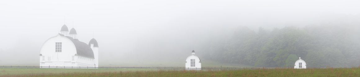
I have taken many photos of the outbuildings on the Carsten Burfiend farm, but never from this angle. The fog totally obscured the hill in the distance. The image by itself has a hard time standing on its own, but it may contribute to some future story.

The farms at Port Oneida no longer operate. They were acquired by the National Park Service over 50 years ago. The buildings now stand witness to a past community that eked out a hard living farming the sandy soil. The buildings are not, however, the only witnesses. If you look closely, you can find other signs of the past. Among those signs are fence posts that still stand, though the fences themselves are long gone.


