According to the historic marker at Trestle Park, on Summit Avenue, in Algoma Township, north of Rockford, Michigan, the Grand Rapids & Indiana Railroad hired a local farmer to build a stone culvert under a railroad trestle that crossed what was then known as Wicked Creek (now called Stegman Creek). Completed in 1885, the culvert is an amazing feat of construction. It seems incredible that a local farmer would have the engineering skills and tools necessary to build such a structure. The railroad and trestle are long gone, but the White Pine Trail now passes over the culvert on its 92-mile journey from Grand Rapids to Cadillac, Michigan.
Category: Rivers and streams
A Last Bit of Winter Photography

I made one more visit the the Leelanau Peninsula near the end of March to have one more shot at winter photography. I headed straight to Good Harbor Bay to get some shots of Shalda Creek before sunrise. I had great light for about 15 minutes and made the most of it. Then the clouds rolled in.

Click to enlarge

Click to enlarge

After the clouds rolled in I wandered around the park taking random shots.


Up North on the First Full Day of Winter
I wandered north on Saturday, December 22, to do some photography on the first full day of winter. Unlike my usual trips that begin long before dawn, this trip started at 10 a.m. I was at Point Betsie by 1:00 p.m. On such a gloomy day, it didn’t matter that I was shooting at mid day. There is still so much beauty on a cloudy day. And I found lots of it on the Platte River as it prepares to flow into Lake Michigan. But, my intention in starting out late was to shoot at dusk and after sunset to capture a photo of Art’s Tavern, festively lit for the holidays, and Fishtown in Leland, which is also sporting festive, though less garish, lights.
Point Betsie
You may remember from my photos of the Point Betsie lighthouse last year how it gets consumed by ice. Well, winter is being very slow in coming and there is just a little bit of ice beginning to form. You have to start somewhere.


The Platte River
The Platte River flows into Lake Michigan at the south end of the Sleeping Bear Dunes National Lakeshore. As it approaches the lake, it passes some low sand dunes. The ice forming on the grasses on the river’s edge intrigued me — like diamonds forming on the shore.


The reflection of the dunes in the slow moving river caught my eye.


Art’s Tavern, Glen Arbor, Michigan
It’s always worth the drive to Art’s Tavern. But Art’s gets bonus points this time of year for its festive decorations.

Fishtown, Leland, Michigan
In the latter part of the 1800s, Leland became a fishing town for white settlers on the Leelanau Peninsula. They joined native people who had fished Lake Michigan for hundreds of years. The shanties in Fishtown began to be constructed at the turn of the 20th century. The Janice Sue and the Joy are two fishing tugs that still conduct commercial fishing operations out of the Leland harbor.


A Moment of Zen at Copeland Falls
One More Shot from the Calypso Cascades

Hiking the Wild Basin Trail to the Calypso Cascades
I hiked the Wild Basin Trail in Rocky Mountain National Park on Friday. I hiked to the Calypso Cascades, a round trip hike of 3.6 miles with a 700 foot elevation gain.
Just three tenths of a mile from the trailhead, a hiker is rewarded with views of lower and upper Copeland Falls.


Hiking along North Saint Vrain Creek, the sound of rushing water accompanied me most of the way.

Another mile up the trail from the Copeland Falls, the Wild Basin Trail Crosses North Saint Vrain Creek.

The Calypso Cascades are another three tents of a mile up the mountain. The flow was down this time of year, but the falls are still a spectacular view.


Ouzel Falls are another nine tenths of a mile up the trail with additional gain of 250 feet. I had originally hoped to get to Ouzel, but daylight and my water supply were getting low. Perhaps another day.
New Snow on Honey Creek
The end of the week brought several inches of new snow to west Michigan, covering the rocks and shoreline of Honey Creek with a smooth blanket of snow. 


On a Cloudy Day, Go Close
Yesterday was a gray winter’s day. Early in the day, I set out to shoot some landscape photos. The trees were flocked with a new coat of snow, but the light was so diffuse that the photos all looked flat and dull. So I shifted gears and decided to look more closely at the landscapes and find mini-landscapes in the details. I headed to one of my favorite spots, Honey Creek, for these shots. (Click on images to see them larger.)


Point Betsie and beyond
I drove up to the Leelanau Peninsula early yesterday morning and stopped at the Point Betsie Lighthouse along the way. The lighthouse was constructed in 1858. In the winter it becomes a magical place of ice and light. 


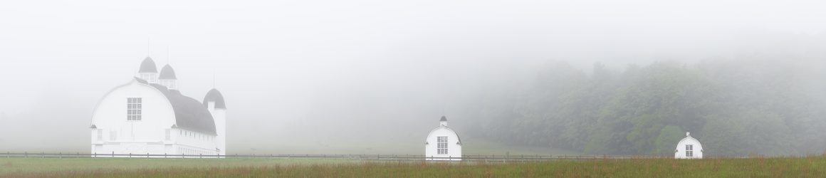
A couple of shots of the Tweedle Farm near Empire in the Sleeping Bear National Lakeshore.


The Empire Lighthouse

Shalda Creek where it passes under Bohemian Road.

The Crystal River at the first portgage.

Fall’s Approach
The fall colors have generally yet to come to our area in West Michigan. We are in the midst of a mini-drought (the third driest September since 1892). We are seeing a lot of leaves simply dry up and fall off the trees with revealing their spectacular colors.
Still there are signs of fall. The morning air has turned much cooler with lows dipping into the low forties and high thirties. This causes fog to form in low lying fields and especially around bodies of water, which still retain some of the warmth from our 80 and 90 degree temperatures from just a couple of weeks ago.
Yesterday morning, in my wanderings, I drove across the Grand River in Ada and saw the mist rising from the water. I turned around and found a boat launch where I could park and explore the waters edge. Here are some photos.


From the shores of the Grand it was just a short trip to Seidman Park and Honey Creek. I brought along my waders so I could get down into the creek and get closer to the rocks.


