I headed north on Saturday, a day after the vernal equinox, to see what was left of the ice on Lake Michigan. Ice break up can be pretty dramatic as the wave action pushes large slabs of ice onto the shore. Here are a few images from my morning on the shore.
Earlier this week, I traveled north to the Leelanau Peninsula to see what winter has brought to northwest Michigan’s shoreline. I began my exploration in Frankfort, Michigan, where the Betsie River flows into Lake Michigan. Snow and sand were piled up on the beach while the lighthouses that mark the opening of the harbor were covered in ice.
On the shoreline was a collection of benches. They faced the town, but one bench stands sentinel, looking towards the lake.
A few miles north of Frankfort, is the Point Betsie Lighthouse. I have photographed here many times. It is especially interesting in the winter when the ice forms of the trees and the breakwaters.
North of Frankfort, after you enter the Sleeping Bear Dunes National Lakeshore, you cross the Platte River. I followed the river down near where it enters Lake Michigan. As it makes a turn to the lake, it cuts through an area of dunes.
Sand Dunes on the Platte River
Another ten miles or so north is Empire, Michigan. As you stand on the beach, Empire Bluff is to the south, while the Sleeping Bear Dunes are in this distance to the north.
Empire BluffSleeping Bear Dunes
I stopped near the Dune Climb to photograph the frozen mill pond and the snowy dune.
Sleeping Bear Dunes
I finished my trip with a visit to Good Harbor Bay, where Shalda Creek flows into Lake Michigan. It always interests me to see the path the Creek cuts to make its way to the lake.
Earlier this week, I visited Sleeping Bear Dunes National Lakeshore. Initially, I set out to photograph on Esch Road Beach, but the cold temperature and high winds convinced me that I needed to find a spot sheltered from the wind. I made my way to Good Harbor Bay at the point where Shalda Creek empties into Lake Michigan.
Shalda Creek originates at the west end of Little Traverse Lake and winds its way through wetlands and the forest until it reaches Lake Michigan. I make a point of stopping there on almost every visit to check out the work of the beavers who are altering the landscape as they dam the creek and to enjoy the peaceful surroundings, which I usually have to myself. Notwithstanding the work of the beavers, the creek keeps flowing toward the lake making its mark on the land.
The force of the water continually adjusts the path of the creek as it approaches the lake. Each time I visit, the mouth of the creek has moved a little or a lot.
On Wednesday’s visit, I found the creek had formed a small depression in its path creating a mini-waterfall.
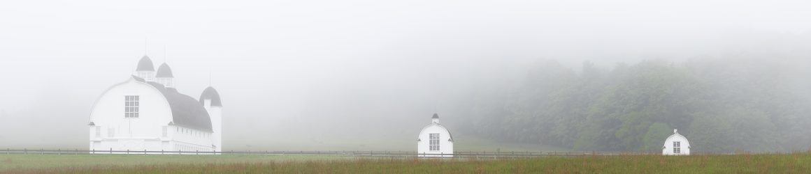
North Unity was a community founded in 1855 on Good Harbor Bay in Leelanau County, Michigan. The community was founded by families from Bohemia, which today is part of the Czech Republic and Germany. Francis and Antonia Kraitz were two of the first members of the community. They built this cabin in 1856.
The Kraitz cabin is just inside the border of the Sleeping Bear Dunes National Lakeshore. When the National Park Service took possession of the cabin, it was covered with clapboard siding and appeared to be a run-down 1940s-era cottage. But, upon removing the siding, the Park Service found a well-preserved log cabin. The cabin has just recently been restored by volunteers from Preserve Historic Sleeping Bear, a nonprofit partner of the National Park.
The Bohemian community of North Unity was were served by itinerant priests from the Catholic mission at Peshawbestown. Services were conducted in the homes of the congregation until this church building was completed in 1886. Today, the St. Joseph Parish has been merged with St. Rita’s Parish in Maple City. Mass is conducted in the St. Joseph Church only twice a year.
North Unity was established Shalda Creek where it flows into Good Harbor Bay.
This is one of my favorite places in the National Lakeshore to take photographs. The area is changing due to nature’s engineers. Beavers have built a small dam on Shalda Creek flooding the area behind it.
One final shot. This one was taken on Narada Lake. The old North Unity School sits on the shore of Narada Lake. I wasn’t able to get a good photo of it yesterday. (It is basically the same construction as the Kraitz cabin.) But, I thought this image was worth taking.
The fall colors in northern Michigan are past their peak, but I was still treated to a beautiful color show yesterday at the Sleeping Bear Dunes National Lakeshore. This first photo, taken where Shalda Creek crosses Bohemian Road, reminds me of the final words from Thoreau’s Walden Pond: “Only that day dawns to which we are awake. There is more day to dawn. The sun is but a morning star.”
Shalda Creek snakes through Sleeping Bear just south of Good Harbor Bay and pours out into the bay. Shortly before it does so the beaver have built a dam creating a pond in the forest.
As I passed by, I noticed the reflection of the golden leaves in the still water of the pond and stopped to take these photos.
Driving home along Indian Hill Road in Benzie County, I pulled over to take this photo of a lone tree in a plowed field.
Yesterday was a beautiful winter’s day, with plenty of sunshine, something we see little of this time of year. It has been a quiet winter, with with relatively warm temperatures and lots of clouds. On the Leelanau Peninsula, where I headed yesterday, they had received just 26.4 inches of snow as of Wednesday morning, compared to 87.8 inches a year ago. So far in January, the Leelanau has received just 4 inches.
I arrived at Good Harbor Bay an hour before sunrise. It’s a very short walk through the woods to where Shalda Creek flows into the Bay. The clouds were beginning to break up, allowing morning’s first light to illuminate the scene.
There was just a thin layer of ice on the beach.
I hiked back into the woods, following Shalda Creek upstream, but couldn’t find a composition. So, I got back in my car and drove to Esch Road Beach, south of Empire. I have pictures from years past in which the ice pack had mounded along the beach. That’s not the case this year, though the surf is transforming this tree into an ice sculpture.
My final shooting location before grabbing lunch and hiking on the Sleeping Bear Dunes Trail was Inspiration Point above Big Glen Lake.
While at Inspiration Point, I took a moment to photograph the Faust Cabin, which was build in 1929.
I tarried at Inspiration Point for a while, enjoying the view and watch a bald eagle soar over the open water, perhaps keeping an eye out for a meal.
On Saturday I headed to Sleeping Bear Dunes National Lakeshore hoping to find fall colors. I got an early start, as usual, arriving an hour before sunrise. Before the sun came up I shot several photos, experimenting with intentional camera movement. No two photos are the same. And sometimes the result is surprising.
The forecast was for a cloudless sky, which was basically true. But this band of clouds appeared and stretched across the sky.
As the band of clouds moved south, it caught the light of the sun, which was still below the horizon.
Shalda Creek flows into Good Harbor Bay. The salmon were running, heading upstream to spawn.
In the northern part of the park, the trees had not reached their peak color, but I was able to isolate some patches of color reflected in Bass Lake.
Birch trees at Point Oneida. The trees are no longer alive. They have been drowned by an expanding beaver pond and now serve as food for the beavers.
Looking down at North Bar Lake from stop number 10 on the Pierce Stocking Scenic Drive. This view shows just how green it was close to Lake Michigan.
The fall colors became much more vivid as I got a bit more inland from Lake Michigan. So I stopped at the Brown Bridge Quiet Area near Traverse City for some quick shots before coming home.
The meadow in the Brown Bridge Quiet Area used to be under a pond that was created when they dammed the Boardman River. The dam was removed in the summer of 2012.